Q&A with Jonathan Stewart about what his team learned in the aftermath of the Ridgecrest quakes
A day after a magnitude 6.4 earthquake on July 4 rattled Southern California, a small team of earthquake engineers and scientists was already near its epicenter, in Ridgecrest, Calif., gathering time-sensitive data.
The team is part of the Geotechnical Extreme Events Reconnaissance Association, which is supported by the National Science Foundation. The initial seven-member team was organized by Jonathan Stewart, professor of civil and environmental engineering at UCLA. Other UCLA members of the reconnaissance team included professor Scott Brandenberg, and graduate student Pengfei Wang, as well as UCLA alumni Sean Ahdi, of the engineering and scientific consulting firm Exponent, and Christine Goulet, of the Southern California Earthquake Center. More researchers joined the team in subsequent days including UCLA post-doctoral researcher Buka Nweke.
Stewart answered a few questions about what the team does in the field.
Q: What do you look for in the field? And why is it critical to go in the first few days following an earthquake?
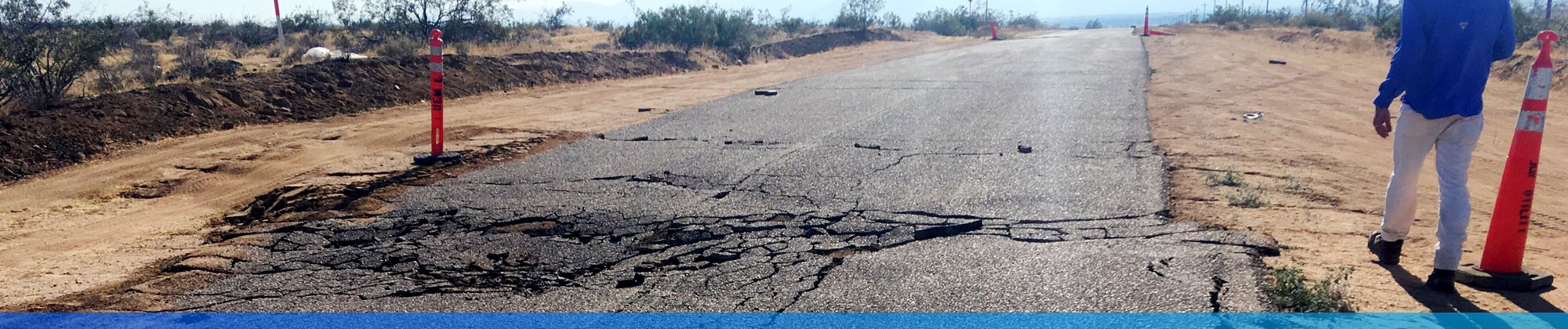
Stewart: It is important to get into the field as quickly as possible after an event for two main reasons. One reason is that the data we are collecting is perishable. For example, in this earthquake we were examining ground deformations related to the fault rupture and soil liquefaction. These both take the form of ground cracks of various sizes. As people walk over these features, or if rain were to occur, much of the evidence would be lost.
A second reason for rapid response is that subsequent events can alter the ground deformation features we are interested in. For this deployment, we were able to get into the field on July 5, the day after the magnitude 6.4 event, and as a result we were able to see ground deformation features caused solely by that event. We revisited those and other sites following the July 5, magnitude 7.1 event. Some of the sites had no additional deformations, while others had new or significantly increased levels of deformation. We can associate observations with specific events because of the rapid response.
We often need to balance this need for rapid response with staying out of the way of first-responders, especially when collapsed structures have produced casualties. Fortunately, that was not an issue for this deployment, so we deployed rapidly.
Q: What will the collected data be used for?
Stewart: The data is used for a variety of purposes, but its main purpose is to describe field performance of natural and man-made systems to help earthquake engineers and earth scientists understand various processes related to seismic risk — ground shaking, ground failure, structural and system response. We use the data, and other tools, including physics-informed simulations, to develop models used for seismic hazard and risk characterization. In short, field data collected after major earthquakes directly impacts public safety and earthquake preparedness.
For example, models built in part from this data will be incorporated in updated seismic hazard maps, which are then used in building codes and to guide land development.
Q: What’s the most important field tools for your research and what do they help determine?
Stewart: GPS sensors determine the location of observed effects. Unmanned aerial vehicle overflights enable imaging of observed features and the development of 3D models of post-event terrain. This is useful to evaluate the extent and amount of ground deformations. We also use basic mapping tools – including a tape measure, compass, etc.
The team will post an initial report at GEER’s website in the next few weeks. To best prepare for an earthquake, visit the many resources available online including: https://www.scec.org/learn.
Knowledge@Wharton
AUDIO
Stewart and UC Berkeley Professor Mary Comerio discuss how prepared California’s populated areas are for earthquakes on the Knowledge@Wharton radio show. The program originally aired on Sirius XM Channel 132, Business Radio Powered by The Wharton School.