University of California, Los Angeles
January 31 – February 4, 2022


USGS Shakemap/ShakeCast and National Seismic Hazard Model Workshop for Lifeline Systems
People are encouraged to attend the USGS-1 session and the USGS-2 session, but registering for this workshop does not require attendance to both sessions.
Limited Seating. This event requires an additional ticket. You can reserve your seat by adding the extra ticket during the registration process. The tickets are free (no charge).
Friday, February 4, 2022
8:00 am – 1:00 pm PT

USGS-1: ShakeMap/ShakeCast Technical Users Workshop
David Wald¹, Kuo-Wan Lin¹, Yagie Lee², and John Eidinger³
¹ U.S. Geological Survey, Denver Federal Center, PO Box 25046, MS 966, Lakewood, CO 80225
² ImageCat, Inc., 400 Oceangate, Suite 1050, Long Beach, CA 90802
³ G&E Engineering Systems, Inc., P.O. Box 3592, Olympic Valley, CA 96146-3592
Additional speakers or panelists may be added to the program
ShakeMap is U.S. Geological Survey (USGS) premier tool for rapidly mapping out the distribution and intensity of shaking immediately after earthquakes. The same tools use mapping out shaking based on ground shaking observations are also widely used for planning in the form of ShakeMap scenarios. ShakeCast® is a (USGS) software application that automatically retrieves ShakeMap shaking estimates and performs analyses using fragility functions for buildings and lifelines. The ShakeCast system aims to identify which facilities or lifeline segments are most likely impacted by an earthquake—and thus which ones should be prioritized for inspection and response—and sends notifications to responders in the minutes after an event. By focusing inspection efforts on the most damage-susceptible facilities in the severely shaken areas, ShakeCast can reduce critical lifeline inspection prioritization and response time in the aftermath of a significant earthquake. Overviews and technical specifications of the ShakeMap and ShakeCast software have been presented at earlier conferences; we will describe only significant updates. Rather, we focus on uses and users and their response protocols to provide further insight into the use of the ShakeMap/ShakeCast combination. We focus on users responsible for monitoring and response for lifeline infrastructure, and we emphasize inventory, fragility, and notification issues pertinent to the lifeline engineering audience.
USGS-2: Lifelines Uses of the USGS National Seismic Hazard Model
Nicolas Luco1, Ben Mason1,2
1U.S. Geological Survey, Geologic Hazards Science Center, Golden, CO
2Oregon State University, School of Civil and Construction Engineering, Corvallis, OR
Additional speakers or panelists may be added to the program
The U.S. Geological Survey (USGS) National Seismic Hazard Model (NSHM) is used for a broad array of earthquake risk mitigation applications, such as construction codes and insurance. To facilitate these uses, but also to motivate improvements and provide feedback, USGS civil engineers (both structural and geotechnical) liaise with numerous NSHM stakeholders, such as the Building Seismic Safety Council (BSSC), the American Association of State Highway and Transportation Officials (AASHTO), and the American Railway Engineering and Maintenance-of-Way Association (AREMA). Recently, the USGS was approached by developers of an American Society of Civil Engineers (ASCE) manual of practice for seismic design of buried water and wastewater pipelines. As a result, the USGS is adding peak ground velocities to the outputs of its NSHM. The purpose of this workshop session is to engage additional lifelines users of the USGS NSHM. Discussion topics will include additional NSHM use cases, such as assessing the seismic risk to pipelines and soil-structure interaction, and additional NSHM products, such as alternative ground-motion intensity measures for ground failure assessments.
USGS-1 AGENDA
ShakeMap – What’s New [30 Min]
David Wald
· Mulitperiod ShakeMap
· ShakeMap Sampling Tool for engineering forensics
· Scenarios, Atlas, gmprocess, and more…
· Examples
ShakeCast for Lifelines — What’s New [30 Min]
Kuo-Wan Lin
· Software updates, cloudification
· AEBM/G2F/design-level triggers
· ShakeCast Users in the Lifelines Arena
Guest Speaker (John Eidinger, G&E Engineering) [20 Min]
· Seismic Fragility of electric utility systems… 2022 update
User Insights (Yajie Lee, ImageCat) [10 Min]
· ShakeCast use at ImageCat
Discussion/Feedback [30 Min]
USGS-2 AGENDA
Welcome; objectives [5 Min]
Nicolas Luco
Introductions [5 Min]
Ben Mason
The National Seismic Hazard Model (NSHM):
· Development of 2023 NSHM [15 Min]
Sanaz Rezaeian
· USGS Unified Hazard Tool [15 Min]
Peter Powers
· Q&A [15 Min]
Example Uses of the NSHM for Lifeline Systems:
· Geospatial innovations in assessing the seismic vulnerability of pipelines and critical facilities [5 Min]
Ron Eguchi
· Preliminary national-scale seismic risk assessment of natural gas pipelines in the United States [5 Min]
Simon Kwong
· Assessing direct and indirect long-term economic impacts from earthquakes to the U.S. National Bridge Inventory [5 Min]
Kishor Jaiswal
· Probabilistic seismic risk evaluation of the City of Los Angeles water system pipeline network [5 Min]
Yajie Lee
· Risk-targeted loads for seismic design of lifelines: opportunities and challenges [5 Min]
Craig Davis
· Q&A [15 Min]
Break [10 Min]
Discussion of Additional Uses & Impacts on the NHSM:
· Outcomes of 2021 NSHM user-needs workshop [15 Min]
Ben Mason
· Discussion [30 Min]
USGS-1 Speakers
USGS-2 Speakers
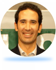
Nicolas Luco Research Civil Engineer at USGS

Ben Mason Research Civil Engineer at USGS

Craig Davis
CA Davis Engineering, Retired LADWP

Ronald T. Eguchi
CEO and Co-Founder of ImageCat

N. Simon Kwong
Research Civil Engineer at USGS

Sanaz Rezaeian
Research Structural Engineer at USGS

Kishor S. Jaiswal
Research Structural Engineer at USGS

Yajie Lee
Director of Catastrophe Model Development at ImageCat
Conference Organizers
Collaborating Partners
Supporting Organizations


Sponsors
Platinum Sponsors

Gold Sponsors
Silver Sponsors
Bronze Sponsors
Coffee Break Sponsors

